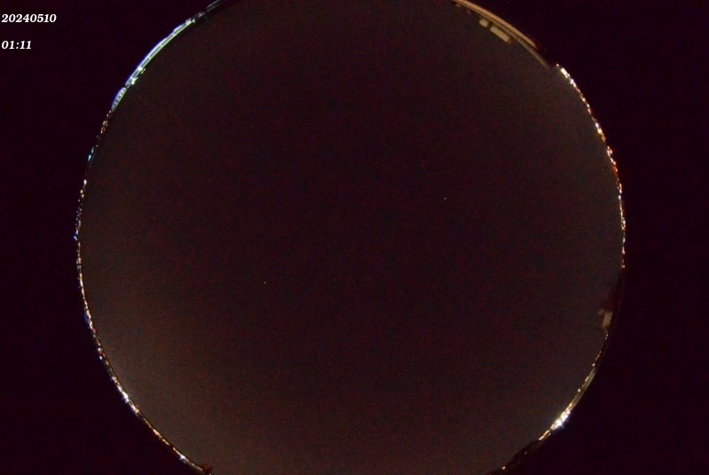
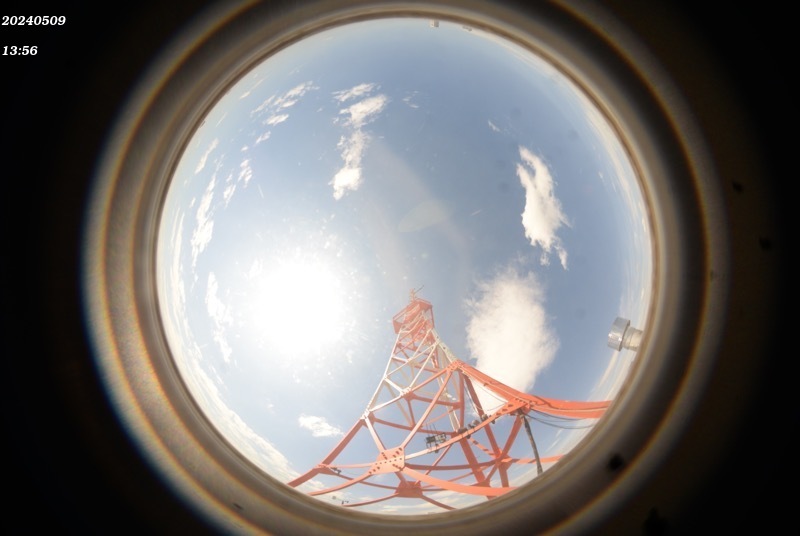
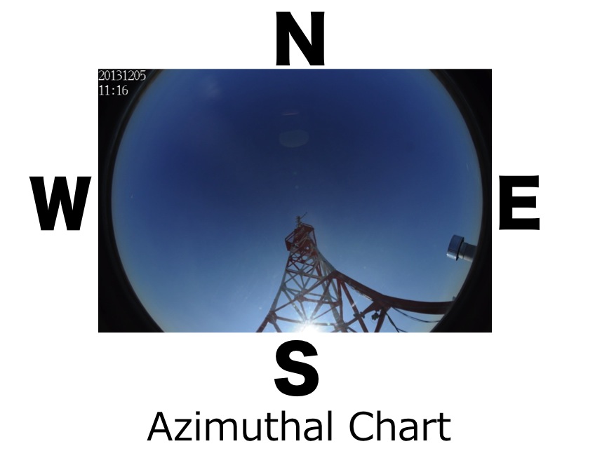
Tokai University Automatic Cloud Photograph Acquisition System
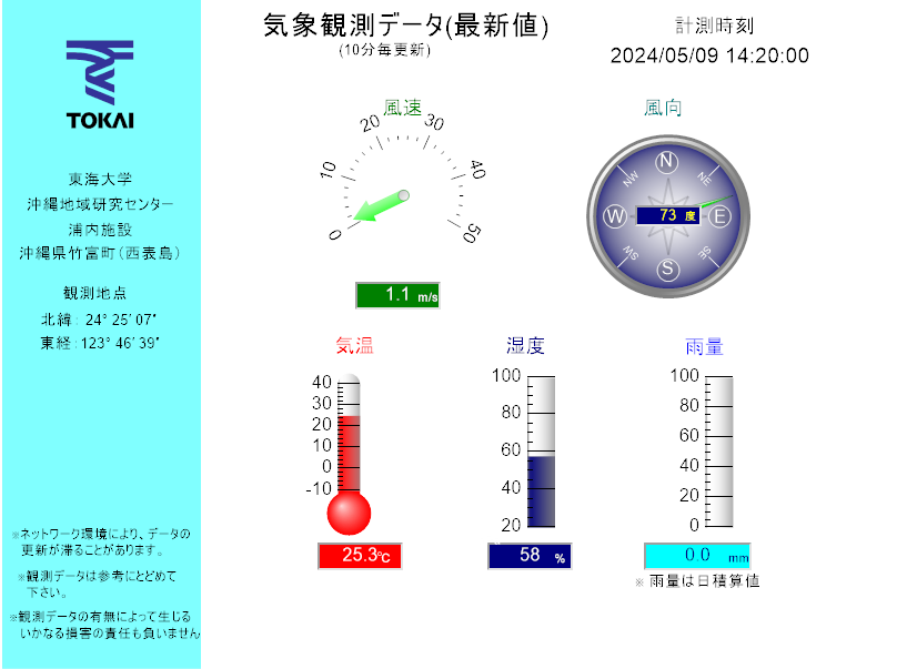
Tokai University Meteorological Observation System
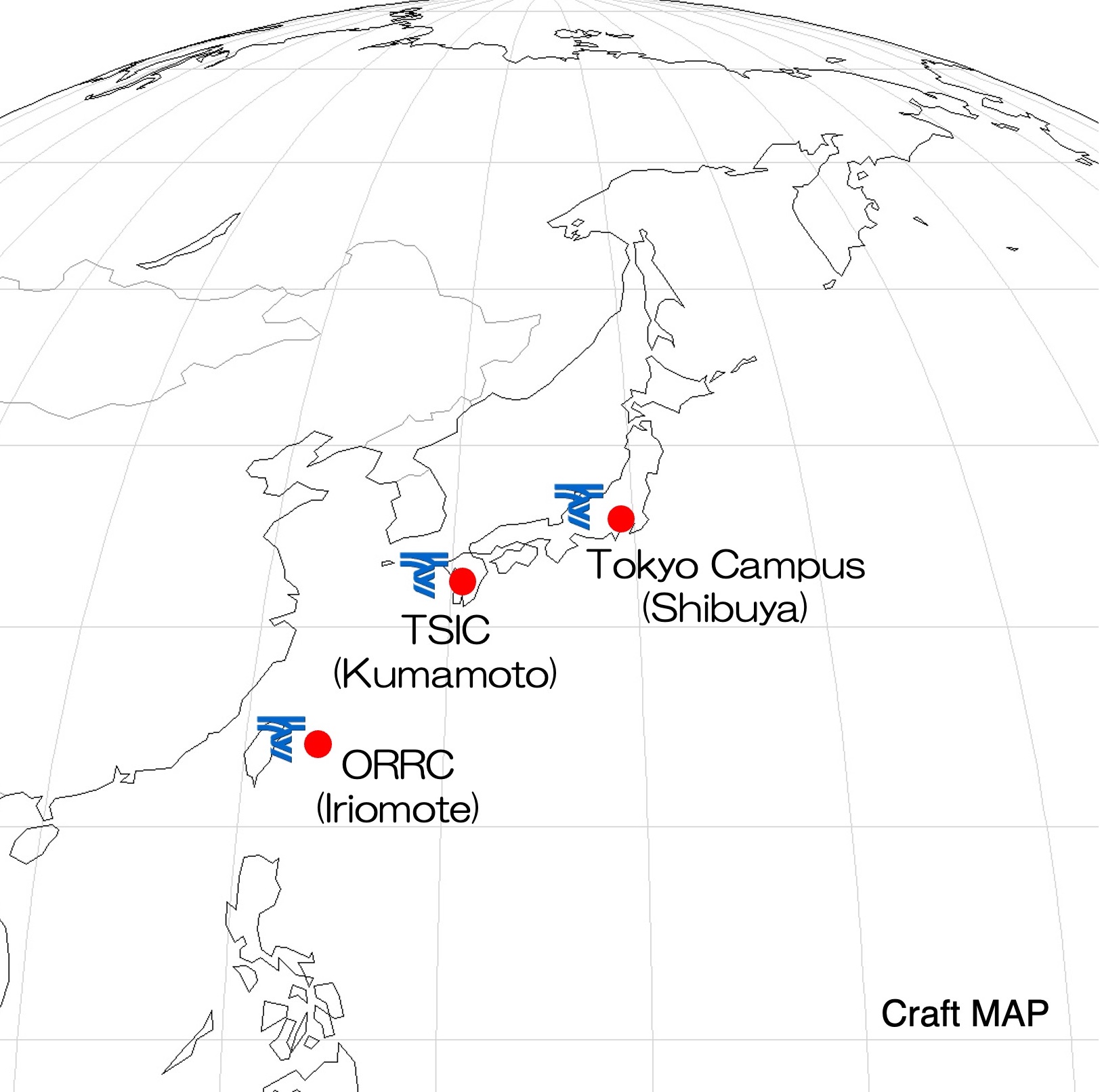
Iriomote, Okinawa
ORRC, Tokai University

Lat. 24°25’07″(24.419076)
Lon. 123°46’39″(123.777874)
Movie of the cloud yesterday
Kumamoto
TSIC, Tokai University
Lat. 32°48’43” (32.811909)
Lon. 130°44’37″ (130.743611)
Movie of the cloud yesterday
* No meteorological observation equipment
Tokyo Campus, Tokai University
Lat. 35°39’52″(35.66459)
Lon. 139°41’04″(139.684577)
Movie of the cloud yesterday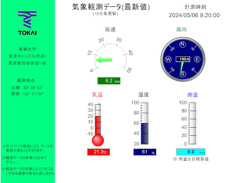
Observation value in the last one month
Map
* Click to enlarge images of cloud photographs and observation value
DISCLAIMER
Authorized use of this data is limited to the academic and researches. Use is not authorized for operational or commercial purposes. The origin of the photographs and data should be always acknowledged. Also, the users should assume complete responsibility for any direct and indirect damages due to the use of photographs, data, and so on.
Research grants
1.JAXA, GCOM/SGLI project, Principle-investigator:Takashi Nakajima
2.National Institute for Environmental Studies, GOSAT project “Development of the algorithms for cloud screening and retrieveing the cloud optical and microphysical properties using TANSO/CAI” Principle-investigator:Takashi Nakajima
3.Grant-in-Aid for Scientific Research (B) 21300294, “Earth Observation & Education” Principle-investigator:Kohei Cho
4.Japan Weather Association, “Improvement of fog detection algorithm” Principle-investigator:Takashi Nakajima